
Stash + Metromap
We are excited to announce the launch of Metromap aerial imagery inside Stash
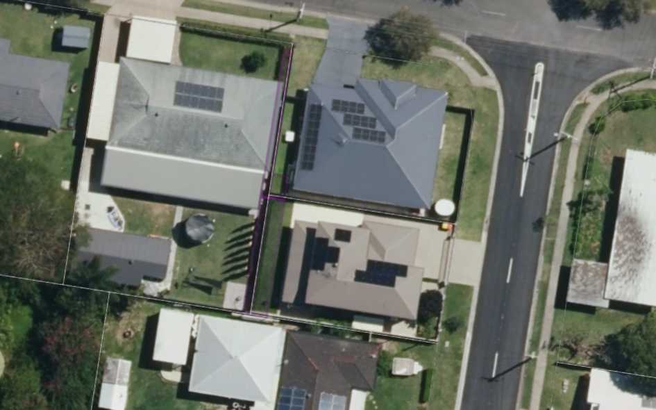
See the property developments as they come out of the ground. Don’t waste time visiting potential development sites only to find they are mid development. View development precedents in real-time.
When it comes to aerial imagery, Google Maps has long been the go-to choice for individuals and businesses alike. However, a new contender has emerged in the realm of aerial mapping.
Metromaps offers distinct advantages that set it apart from Google Maps. In this article, we will explore why Metromaps has gained traction as a superior option for aerial imagery and how it outshines Google Maps in various aspects.

About Metromap
Metromaps is an innovative aerial mapping service that specializes in providing high-resolution and up-to-date aerial imagery for urban areas. With a strong focus on cities, Metromaps offers unparalleled detail and precision, catering to the specific needs of urban planning, architecture, and related industries. By leveraging advanced aerial photography techniques and a swift update cycle, Metromaps ensures that its imagery reflects the latest developments and changes in urban landscapes.
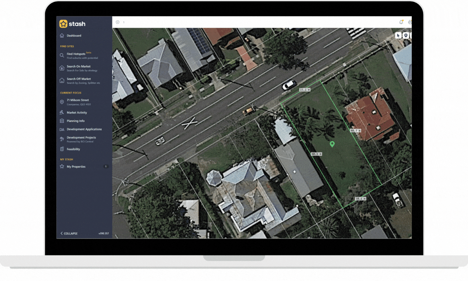
Stash + Metromaps. The latest aerial imagery
The Rise of Metromaps: Why It Surpasses Google Maps for Aerial Imagery
Unmatched Resolution and Detail:
Metromaps prides itself on delivering aerial imagery with unmatched resolution and detail. Leveraging state-of-the-art aerial photography techniques, Metromaps captures high-resolution images that allow for precise analysis and evaluation. Whether you’re conducting environmental studies, assessing infrastructure, or planning urban development, Metromaps’ imagery offers unparalleled clarity and accuracy. In comparison, Google Maps often provides lower-resolution images, limiting their utility for professionals requiring intricate visual details.
Specialised Focus on Urban Areas:
Metromaps differentiates itself by focusing specifically on urban areas, catering to the unique needs of urban planning, architecture, and related industries. By concentrating its efforts on metropolitan regions, Metromaps captures imagery with a sharper focus on cities, delivering enhanced detail and information. This specialized approach allows professionals to make more informed decisions and gain a deeper understanding of urban landscapes. In contrast, Google Maps covers a broader range of locations, which may result in less detailed aerial imagery in densely populated areas.
Rapid Updates and Real-time Data:
Metromaps excels in providing frequent updates and real-time data, allowing users to stay abreast of rapidly changing urban environments. With a swift update cycle, Metromaps ensures that its aerial imagery is continuously refreshed, reflecting the latest developments and changes. This responsiveness is particularly valuable for industries requiring up-to-date information, such as emergency services, transportation planning, and construction projects. In contrast, Google Maps relies on a combination of satellite imagery and third-party providers, which can lead to delays in reflecting recent updates
Limited time only. Every new subscriber gets 7 days to preview how having access the latest aerial imagery can help speed up your research. You can then purchase Metromap aerial imagery for $59 + GST per month.
Metromap is a great addition to the Stash partner network. Innovative technology to help our users save time when selecting development sites.
Find your needle in the haystack today. Sign up for our free trial and start finding great deals fast!
Happy Stashing!